- 16 février 2024
- Coordinateur Erasmus
- 0
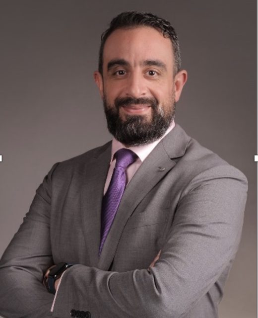
Prof. Adnane Abbaci, partner of the project SEED4NA, started a monthly program for daily video publication focusing on Spatial Data Infrastructure (#SDI), which can provide a comprehensive overview and in-depth knowledge to viewers interested in geospatial technologies and services. Please watch this video:
Day 1: Unraveling Spatial Data Infrastructure (#SDI): https://lnkd.in/
Day 2: Introduction to Spatial Data Infrastructure (#SDI) – Concept and History: https://lnkd.in/
Day 3: The Key Components of #SDI: https://lnkd.in/
Day 4: Importance of #SDI in Modern Geospatial Analysis: https://lnkd.in/
Day 5: Unlocking the Power of #NSDI: Revolutionizing Decision-Making: https://lnkd.
Day 6: Unlock the Power of #SDI: Empowering #Sustainable #
Day 7: The Power of #SDI in Building #Smarter, #
Day 8: Fundamentals of #Computer #Networks for #
Day 9: Understanding #Servers and #

Studying forestry at the National School of Forestry Engineers and holding a PhD in GIS and remote sensing from the University Ibn Zohr in Morocco, Pr. Adnane Abbaci worked for twelve years at the High Commission of Water Forests and Combating Desertification of Morocco, implementing government decisions on forests and watershed management, desertification mitigation and climate change adaptation. In addition, I have developed a regional geospatial database to establish baselines for forest ecosystems assessment and methodology to combat desertification.
His professional interests are in research for sustainable development of natural resources especially forest ecosystems, combating desertification, Smart agriculture, partnership and climate change adaptation and mitigation.
He has spent one year and a half at UC Davis in California, USA. During his fellowship year with the Humphrey Program, he has learned more about monitoring climate change effects on natural resources and geospatial processes to improve the sustainability of forests, to sequestrate carbon and mitigate climate change effects. Specifically, he has earned more technical experience in web mapping, climate change modeling and developing partnerships with international organizations.
He has spent one year and a half at UC Davis in California, USA. During his fellowship year with the Humphrey Program, he has learned more about monitoring climate change effects on natural resources and geospatial processes to improve the sustainability of forests, to sequestrate carbon and mitigate climate change effects. Specifically, he has earned more technical experience in web mapping, climate change modeling and developing partnerships with international organizations.
Since 2018, He is a professor at the Faculty of Sciences of Agadir where he is teaching GIS, remote sensing and Spatial Data Infrastrcuture, supervising master and PhD thesis, and coordinating many projects related to earth observation and spatial data infrastructures, the projet Erasmus+ SEED4NA is one of them.


